 Itinerary
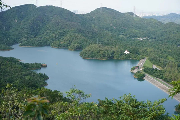
The Honghualing Reservoir located between the 13th and 14th segments of the Kunpeng Trail in Pingshan District. Photo from Daily Sunshine
A new digital guide to Shenzhen’s expanding network of hiking trails is now available on the “美丽深圳” WeChat account (ID: mlszgzh). The guide aims to make trail planning safer and more convenient for residents and visitors exploring Shenzhen’s outdoor routes.
To access it, open the account, tap “公园深圳” on the bottom menu, then select “深圳远足径”. Under the “推荐线路” (Recommended Routes) section, hikers will find many well-known Shenzhen routes — several of which run through Pingshan District, including the Maluan Mountain Hiking Trail Butterfly Trail (马峦山郊野径蝴蝶步道), and sections of Honghualing Hiking Trail (红花岭郊野径), Cuiwei Trail (翠微径), Sanshui Route (三水线), Maluan Mountain Loop (马峦山环线), and Kunpeng Trail (鲲鹏径).
Key features:
Smart search: filter routes by region, difficulty, and duration, or enter keywords to find a suitable trail quickly.
Detailed route pages: with descriptions, suggested itineraries, practical tips, recommended nearby attractions, and user photos and videos.
Map navigation: three viewing modes — satellite, vector, and traffic — to show mountain‑path details clearly.
Emergency support: one-touch access to rescue phone numbers and automatic sharing of the user’s GPS coordinates to speed up assistance.
Practical resources: four main service sections — “户外公约” (Outdoor Covenant) for safety and etiquette, “出行贴士” (Travel Tips) for weather and equipment reminders, “交通信息” (Transport Information) for real‑time bus, metro and parking info, and “服务配套” (Service Facilities) showing restroom and support locations along trails.

ICP Registration Number: 粤ICP备17054870号-1
 Police Registration Number:44031002000124
Website ID: 4403910001
Police Registration Number:44031002000124
Website ID: 4403910001
Government Service Hotline: 0755-12345
Website Technical Support:zwxx@szpsq.gov.cn
Sponsored by: General Office of CPC Pingshan District Committee (General Office of Pingshan District People's Government, Foreign Affairs Office of Pingshan District, and Archives Administration of Pingshan District)


 HOME
HOME PINGSHAN GOVERNMENT
 NEWS
NEWS ABOUT PINGSHAN
 INVEST IN PINGSHAN
 LIFE
LIFE SERVICES
 FAQ
FAQ CHINESE
 FRANÇAIS
 日本語
日本語 한국어
한국어